 Golden Hour Now
Search a city or place name, or enter decimal coordinates as latitude, longitude.
Plan for
Select your location by searching for a city, place name, or coordinates above; click the Use my location button; or click anywhere on the map to choose a custom location. Once selected, simply scroll down below the map to view your golden and blue hour times and other light‑planning details.
At a glance
Death Valley National Park Light
Today
Updated for the selected coordinates and local time. Move the pin for your exact shooting viewpoint.
Selected Location
Coordinates
—
Local Time
Current time: —
Daylight Planner
Plan your shoot around blue hour, golden hour, sunrise, sunset, and daylight.
Photography Weather
Forecast conditions around the selected evening golden-hour window.
Select a location and date to view the forecast.
7-Day Photography Forecast
Compare the next seven upcoming evening golden-hour opportunities at this location.
Select a location to compare the week ahead.
Forecast confidence generally improves as the shoot date approaches. Click any day to load its full daylight, sun-direction, weather, cloud, and quality details.
Death Valley National Park photography guide
Photographing Golden Hour in Death Valley National Park
Death Valley is an extreme-desert light, topographic-shadow and texture destination. The same astronomical sunset can behave very differently at Zabriskie Point, Badwater Basin, the dunes or Dante's View because surrounding mountain ranges control when direct sun actually reaches the landscape.
The default pin is Zabriskie Point. Move the planner to the exact dune field, salt flat, overlook or scenic road before relying on Photography Weather, cloud layers, visibility, wind or sun direction.
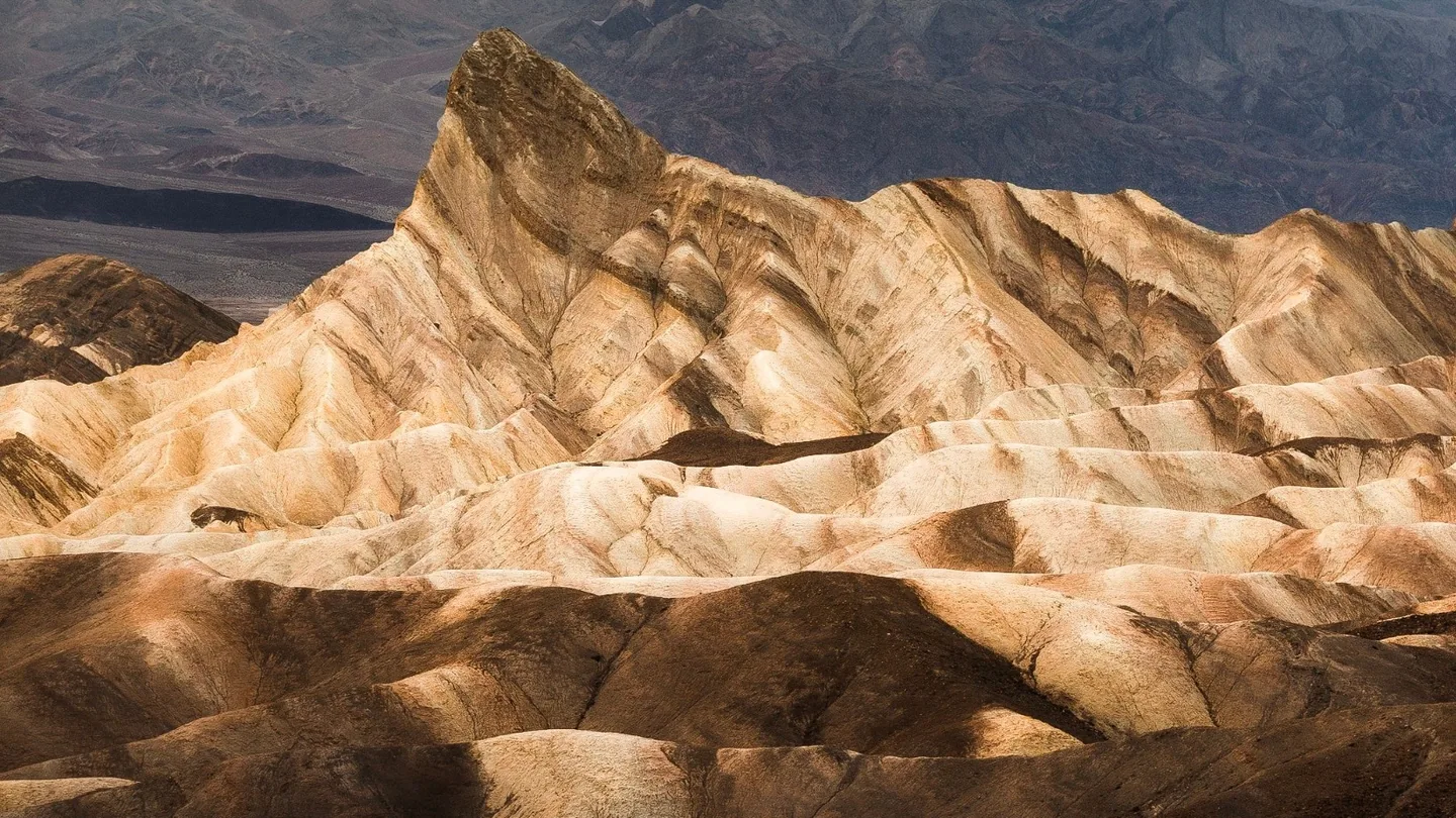
Low-angle sunlight shapes the eroded ridges around Manly Beacon while soft sunset color develops above the Panamint Mountains.
Photo: Trace Hudson / PexelsWhat Photographers Should Know
Light in practice
Death Valley Photography Examples
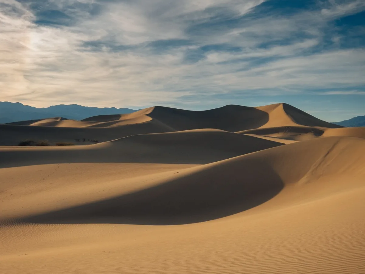
Low sun defines the dune ridges with alternating bands of warm light and deep shadow while fine ripple texture fills the foreground.
Photo: Matteo Di Iorio / Pexels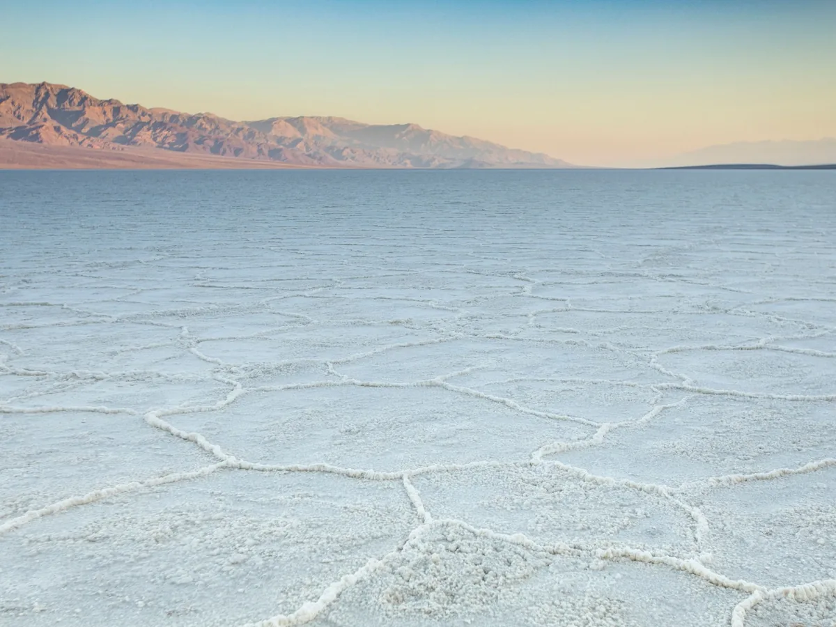
Repeating salt formations create geometric foreground patterns while the Panamint Mountains recede into soft desert light across the basin.
Photo: Stephen Leonardi / PexelsGolden Hour Photography Locations in Death Valley National Park
Zabriskie Point
Badlands + sunrise- Best for
- Manly Beacon, badland ridges, Panamint Mountains, long shadows and telephoto layering
- Access / conditions
- Excellent at sunrise and sunset; topographic shadow changes the actual direct-light window.
Mesquite Flat Sand Dunes
Dunes + side light- Best for
- Dune ridges, long shadows, ripple texture, minimalist compositions and night photography
- Access / conditions
- No formal trail through the dunes; summer heat can become dangerous quickly.
Badwater Basin
Salt polygons + sunset- Best for
- Salt-flat geometry, Panamint Mountains, low-angle light and minimalist foregrounds
- Access / conditions
- Salt crust is fragile; stay on allowed access routes and avoid damaging surfaces.
Dante's View
Valley panorama- Best for
- Badwater Basin from above, Panamint Range, sunrise, sunset, storms and night sky
- Access / conditions
- High elevation can be dramatically cooler than the valley floor.
Artists Palette / Artists Drive
Colored geology + late light- Best for
- Mineral-colored ridges, compressed layers, directional shadows and abstract telephoto work
- Access / conditions
- Best in late light; Artists Drive has vehicle-length restrictions.
Topographic shadow
The Sun Can “Set” Before Sunset
Official sunrise and sunset times describe the astronomical horizon, but Death Valley's mountain ranges can block direct light much earlier or later at a specific viewpoint. Use GoldenHourNow's solar timing together with exact viewpoint geometry rather than assuming official sunset equals the end of direct light.
Location strategy
Sunrise vs. Sunset by Viewpoint
Zabriskie Point is strong at both sunrise and sunset; Mesquite Flat Dunes benefit from low-angle light in either direction; Badwater often becomes especially graphic at sunset; Dante's View can work at either end of the day. There is no single best window for the entire park.
Dune light
Photographing Sand Dunes: Shadow Is the Subject
Dunes become three-dimensional when side light separates bright faces from dark slopes. Low sun reveals ripple texture, ridge lines and footprints. Often the strongest dune photograph is aimed away from the sun at dunes being illuminated by it.
Dune surfaces
Footprints & Clean Dune Ridges
Pristine dune surfaces are never guaranteed at Mesquite Flat. Sunrise generally offers the best chance of cleaner surfaces. Walk farther from the parking area when conditions allow and use longer focal lengths to isolate undisturbed ridges without damaging vegetation.
Salt foregrounds
Badwater Salt Polygon Foregrounds
Salt polygons can act as leading lines and repeating geometric foregrounds. Low camera positions and wide lenses can emphasize pattern, but the salt crust is fragile. Do not drive or create damage for a composition.
Heat safety
In Summer, Photography Weather Is Also Safety Weather
A high sunset-quality score does not mean conditions are safe for extended outdoor photography. Check temperature, carry substantial emergency water, remain near the vehicle during extreme heat, and favor sunrise over long afternoon walks on the valley floor.
Surface temperature
Ground & Sand Temperature
In extreme summer conditions, ground and sand temperatures can exceed already-dangerous air temperatures. Wear proper footwear and minimize time away from shade or a vehicle.
Elevation
Elevation Changes the Forecast
The valley floor and Dante's View differ by thousands of feet. Temperature, wind and cloud exposure can vary sharply between them. Move the planner pin to the exact viewpoint instead of relying on a Furnace Creek-area forecast.
Wind and dust
Wind Can Rewrite the Photograph
Wind can erase footprints, create blowing sand, reduce visibility, destabilize tripods and damage exposed camera gear. Moderate dust can add atmosphere and warm sun-disc color, while heavy wind becomes both an equipment and safety problem.
Camera protection
Blowing Sand & Camera Protection
Change lenses inside the vehicle when possible, avoid exposing the sensor during blowing dust, keep a blower and caps accessible, lower tripod legs in gusty conditions and never leave lightweight equipment unattended.
Cloud interpretation
Cloud Layers & Desert Color
Clear sky supports strong directional side light and dune shadows. High cloud can catch dramatic post-sunset color. Broken mid-level cloud can create shafts of light across mountains and salt flats, while low western cloud can block the sun before the most dramatic low-angle portion of the session.
Flash flooding
Rain, Flash Flooding & Road Access
Rain is rare but can have outsized consequences in Death Valley. Even modest rainfall can trigger flooding, debris and road damage. Treat precipitation probability as an access and safety variable, not merely a photographic one.
Exceptional conditions
Badwater After Exceptional Rain
Badwater can occasionally hold shallow water after unusual rainfall, dramatically changing the photographic scene. Never plan for standing water unless current park conditions confirm it.
Colored geology
Artists Palette in Late Light
Artists Palette's mineral colors become more dimensional under late-afternoon side light. Medium telephoto focal lengths can isolate overlapping red, orange, pink, green and blue-toned ridges while minimizing bright empty sky.
Night transition
Golden Hour Can Become an Astrophotography Session
Death Valley's dark skies support a natural progression from sunset to blue hour to astronomical twilight and night. New moon favors darker skies and Milky Way contrast; a full moon can illuminate dunes and salt flats but washes out faint stars.
Moonlight
Moon Phase & Desert Foregrounds
Use new-moon nights for darker sky and star contrast, and brighter moon phases when foreground illumination matters more. Dante's View, dunes and salt flats can all change character substantially under moonlight.
Road planning
Road Conditions Are Part of Photography Planning
Flash floods, washouts, snow at high elevations and maintenance can change access quickly. Check current National Park Service road conditions immediately before leaving for remote or backcountry viewpoints.
Aircraft
Drone Photography Is Prohibited
Do not launch, land or operate a drone from within Death Valley National Park unless you have specific written authorization from the superintendent. GoldenHourNow does not determine aircraft authorization.
Permits
Photography Permits & Workshops
Most small handheld photography sessions in public areas generally do not require a permit when they do not reserve space, create impacts or require extra park management. Larger or disruptive productions may require authorization, and photography workshops require separate commercial authorization. Verify current NPS requirements before organized production.
Seasonal Photography Planning
Death Valley Photography Workflow
- Choose badlands, dunes, salt flats, colored geology, panorama or night photography.
- Select the exact viewpoint and elevation.
- Check sunrise/sunset azimuth and consider mountain blocking.
- Review cloud layers.
- Check visibility, dust and wind.
- Check temperature and heat risk for the exact location.
- Review precipitation and flash-flood potential.
- Check current NPS road and closure status.
- Protect camera equipment from blowing sand and dust.
- Arrive before the expected low-angle light window.
- Remain through twilight if conditions are safe.
- Do not launch a drone inside Death Valley National Park without specific written authorization.
Nearby Photography Destinations
Future desert coverage can include Alabama Hills, the Eastern Sierra, Valley of Fire, Mojave National Preserve, Anza-Borrego, White Sands, Monument Valley and expanded Joshua Tree coverage.