 Golden Hour Now
Search a city or place name, or enter decimal coordinates as latitude, longitude.
Plan for
Select your location by searching for a city, place name, or coordinates above; click the Use my location button; or click anywhere on the map to choose a custom location. Once selected, simply scroll down below the map to view your golden and blue hour times and other light‑planning details.
At a glance
Sedona Light
Today
Updated for the selected coordinates and local time. Move the pin for your exact shooting viewpoint.
Selected Location
Coordinates
—
Local Time
Current time: —
Daylight Planner
Plan your shoot around blue hour, golden hour, sunrise, sunset, and daylight.
Photography Weather
Forecast conditions around the selected evening golden-hour window.
Select a location and date to view the forecast.
7-Day Photography Forecast
Compare the next seven upcoming evening golden-hour opportunities at this location.
Select a location to compare the week ahead.
Forecast confidence generally improves as the shoot date approaches. Click any day to load its full daylight, sun-direction, weather, cloud, and quality details.
Sedona photography guide
Photographing Golden Hour in Sedona, Arizona
Sedona is a directional-light destination. The best photograph is often not the setting sun itself, but red sandstone receiving low-angle light from the opposite side of the frame. Cathedral Rock, Bell Rock, Courthouse Butte and surrounding mesas change dramatically as solar azimuth shifts through the year.
The default pin is central Sedona. Move it to the exact trailhead, overlook or creek-side composition before relying on weather, visibility or Quality Score. Sedona uses America/Phoenix time year-round.
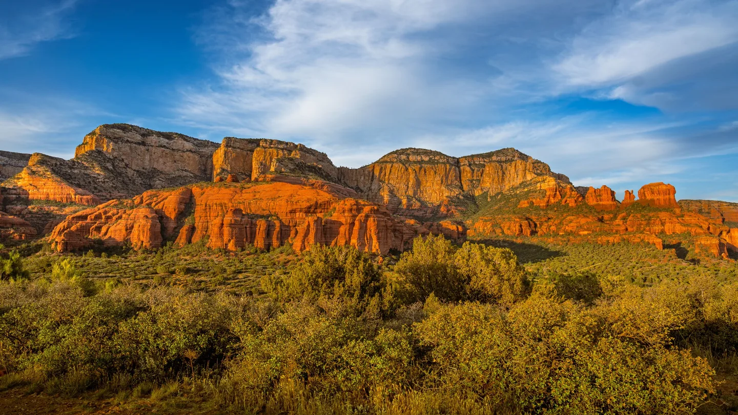
Low-angle evening light can illuminate the formation even when the camera is pointed away from the setting sun.
Photo: Justin Warren / PexelsWhat Photographers Should Know
Light in practice
Sedona Photography Examples
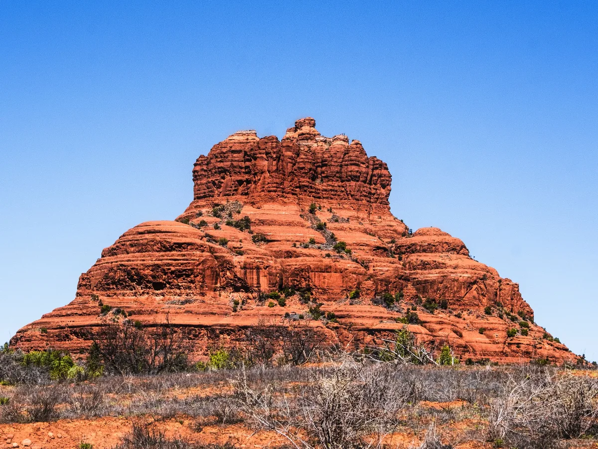
Morning directional light can create warm side light and long shadows.
Photo: Malcolm Garret / Pexels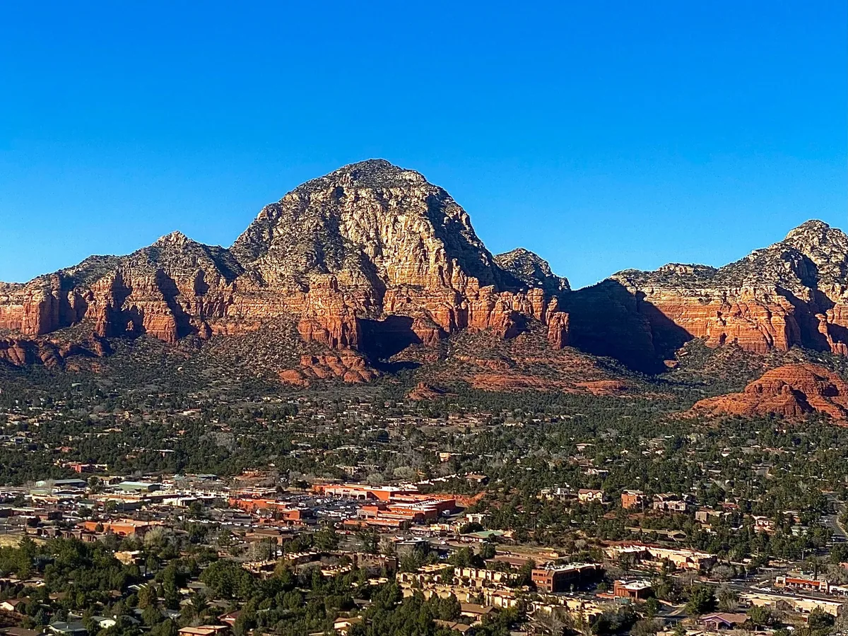
A panoramic overlook helps compare sun direction, cloud structure and blue-hour transition.
Photo: Nicolas Nieves-Quiroz / UnsplashGolden Hour Photography Locations in Sedona
Cathedral Rock / Crescent Moon
Iconic red-rock reflection- Best for
- Cathedral Rock, Oak Creek reflections and glowing sandstone
- Light
- Late afternoon / sunset
- Orientation
- Creek-side compositions toward Cathedral Rock
- Access
- Crescent Moon / Red Rock Crossing area; day-use rules apply
- Seasonal
- Crowds and seasonal creek levels affect compositions
- Notes
- Water level, wind and bank position affect reflections
A defining Sedona composition where low sun can warm Cathedral Rock while Oak Creek adds foreground reflections.
Plan this locationAirport Mesa Overlook
Panoramic sunset- Best for
- West Sedona, Thunder Mountain and surrounding red-rock skyline
- Light
- Late golden hour / sunset / blue hour
- Orientation
- High panoramic overlook
- Access
- Roadside overlook / airport mesa access; limited parking
- Seasonal
- Extremely popular around sunset
- Notes
- Arrive early and keep roadway/trail access clear
A broad elevated view that makes sun direction easy to understand and remains useful as city lights emerge.
Plan this locationBell Rock / Courthouse Vista
Sunrise red-rock light- Best for
- Bell Rock, Courthouse Butte and open foregrounds
- Light
- Sunrise / morning golden hour
- Orientation
- Open south Sedona landscape
- Access
- Trailhead/day-use area; parking/pass rules can apply
- Seasonal
- Busy during peak seasons
- Notes
- Exact compositions vary substantially around the trail system
A strong sunrise location where directional light can separate Bell Rock and Courthouse Butte from the desert.
Plan this locationDoe Mountain Trailhead
Elevated red-rock panorama- Best for
- Mesas, canyons and broad western Sedona landscape
- Light
- Sunrise or sunset
- Orientation
- Elevated mesa panorama after hiking
- Access
- Trailhead parking plus a short, steep hike
- Seasonal
- Heat, ice, storms and trail conditions can affect access
- Notes
- Carry water and leave exposed areas during thunderstorms
A hiking viewpoint that demonstrates why travel and climb time must be added before the astronomical light window.
Plan this locationSchnebly Hill Vista
Layered formations + overlook- Best for
- Munds Mountain Wilderness, red-rock layers and Sedona basin
- Light
- Morning or evening golden hour
- Orientation
- Elevated eastern approach overlooking Sedona
- Access
- Schnebly Hill Road access can be rough and vehicle-dependent
- Seasonal
- Road conditions can change after storms and seasonally
- Notes
- Verify road conditions before relying on vehicle access
A dramatic high viewpoint where rough-road access can determine whether a planned golden-hour shoot is practical.
Plan this locationSignature light
Planning Red-Rock Glow & Alpenglow
Sedona sandstone becomes especially vivid when low-angle sunlight strikes formations directly. A sunset composition may therefore face east or north toward illuminated rock rather than west toward the solar disk.
Use Sun Direction to compare the sun bearing with the face of the formation you intend to photograph. Clouds near the horizon can block illumination while broken clouds can add color and texture, so Quality Score is context rather than a guarantee.
Water + sandstone
Planning Cathedral Rock Reflections
Oak Creek near Red Rock Crossing / Crescent Moon can add reflections and foreground interest. Reflection quality depends on water level, wind, exact bank position and seasonal creek conditions, which are not fully represented by a general golden-hour score.
Sunrise vs. Sunset in Sedona
Sunrise
Bell Rock / Courthouse Vista and elevated viewpoints benefit from cool morning air, long directional shadows and often lighter crowds.
Sunset
Cathedral Rock, Airport Mesa and western overlooks are strong evening choices. Stay through blue hour when clouds retain color or city lights complement the red-rock skyline.
Choosing a Sedona Viewpoint
- Cathedral Rock + reflections: Crescent Moon / Red Rock Crossing.
- Easy panoramic sunset: Airport Mesa.
- Sunrise + open red-rock foreground: Bell Rock / Courthouse Vista.
- Elevated hiking panorama: Doe Mountain.
- High remote-feeling overlook: Schnebly Hill Vista.
Seasonal Photography Planning
Storm-season planning
Monsoon Clouds, Lightning & Flash Floods
Summer monsoon weather can create towering clouds, rain shafts, localized sunlight and rainbows. Those conditions can be spectacular, but exposed mesas, slickrock and canyon drainages are poor places to remain when lightning or flooding threatens.
If thunderstorms develop, prioritize shelter and avoid washes or narrow drainages when flash flooding is possible.
Exact-location planning
Weather, Elevation & Visibility
Temperature and wind can differ between town, creek corridors and exposed overlooks. Smoke or regional haze can also reduce distant red-rock clarity. Use the exact viewpoint before interpreting Photography Weather, particularly for Doe Mountain or Schnebly Hill.
After blue hour
Dark-Sky Photography
Sedona's dark-sky preservation makes the transition from sunset through blue hour into stars a natural extension of an evening shoot. GoldenHourNow plans solar light and weather rather than moon phase, moonrise/moonset or Milky Way geometry, so verify those night-specific variables separately.
Before you travel
Photography, Parking, Shuttle & Trail Access
Popular Sedona trailheads can fill early. Some recreation sites use parking passes or seasonal shuttle service, while rough roads such as Schnebly Hill Road require additional vehicle planning. Verify current access before committing to a light window.
Photography: Commercial or organized activity on managed land can have separate permit requirements.
Drones: Rules depend on the exact land manager, wilderness boundaries, temporary restrictions and FAA requirements. Verify the exact launch location first.
Leave No Trace: Stay on durable surfaces and established trails where required, protect biological soil and vegetation, and do not create new paths for a composition.
Sedona Golden Hour Workflow
- Choose the shoot date.
- Select the exact viewpoint or trailhead.
- Check sun azimuth relative to the rock face you want illuminated.
- Account for terrain blocking direct light.
- Review clouds, precipitation, visibility and wind.
- During monsoon season, check thunderstorm and flood risk.
- Verify parking, shuttle, pass and road access.
- Add hiking time before the light window.
- Compare the 7-day forecast.
- Stay through blue hour when useful.
- For night photography, separately check moon and Milky Way information.
Nearby Photography Destinations
Future pages can expand to Flagstaff, Oak Creek Canyon, Jerome, Prescott, Grand Canyon South Rim, Page / Lake Powell and Monument Valley. Until then, use the worldwide map or search.