 Golden Hour Now
Search a city or place name, or enter decimal coordinates as latitude, longitude.
Plan for
Select your location by searching for a city, place name, or coordinates above; click the Use my location button; or click anywhere on the map to choose a custom location. Once selected, simply scroll down below the map to view your golden and blue hour times and other light‑planning details.
At a glance
Yosemite National Park Light
Today
Updated for the selected coordinates and local time. Move the pin for your exact shooting viewpoint.
Selected Location
Coordinates
—
Local Time
Current time: —
Daylight Planner
Plan your shoot around blue hour, golden hour, sunrise, sunset, and daylight.
Photography Weather
Forecast conditions around the selected evening golden-hour window.
Select a location and date to view the forecast.
7-Day Photography Forecast
Compare the next seven upcoming evening golden-hour opportunities at this location.
Select a location to compare the week ahead.
Forecast confidence generally improves as the shoot date approaches. Click any day to load its full daylight, sun-direction, weather, cloud, and quality details.
Yosemite photography guide
Photographing Golden Hour in Yosemite National Park
Yosemite is a terrain-driven light environment. Granite walls, deep valleys and major elevation changes can block direct sunlight well before astronomical sunset or delay direct morning light after astronomical sunrise. Use the planner for astronomical windows, then use Sun Direction and the exact viewpoint to understand how that light relates to the subject you want to photograph.
The default pin is placed in Yosemite Valley because it is the park's primary photography hub. Conditions can differ substantially at higher elevations such as Glacier Point, so use the exact Plan this location card or move the pin before relying on weather, visibility or the Quality Score.
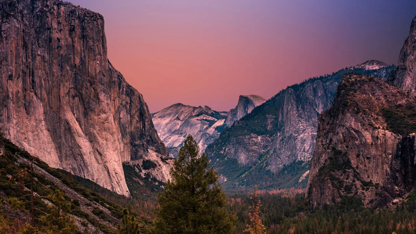
As the sun lowers, Yosemite's cliffs and valley floor enter shadow at different times because of the surrounding terrain.
Photo: Oleg Chursin / UnsplashWhat Photographers Should Know
Light in practice
Yosemite Photography Examples
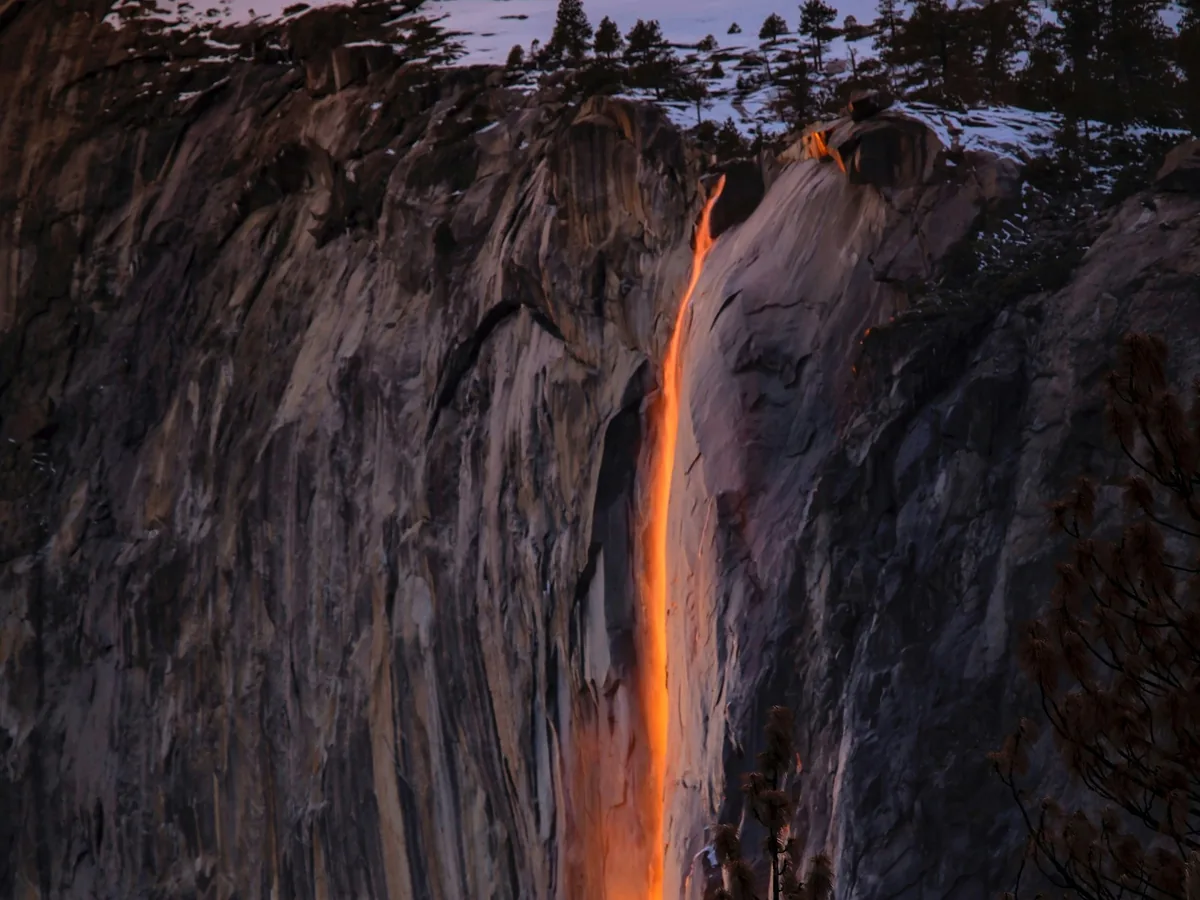
During a narrow late-winter period, sunset can illuminate Horsetail Fall when sun angle, water flow, horizon visibility and clouds align.
Photo: Leo_Visions / Unsplash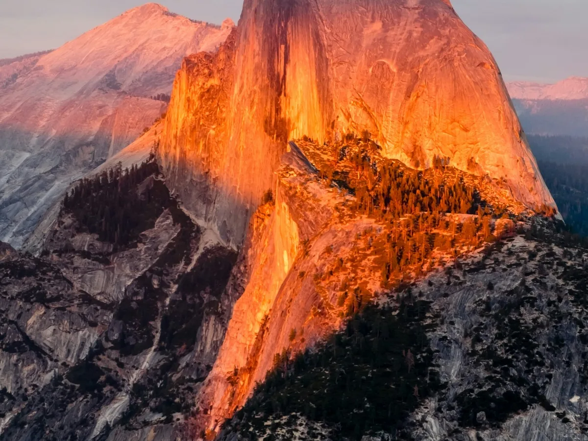
High terrain can leave much of Yosemite in shadow while exposed rock faces continue receiving warm directional sunlight.
Photo: Madhu Shesharam / UnsplashGolden Hour Photography Locations in Yosemite
Tunnel View
Classic valley panorama- Best for
- El Capitan, Bridalveil Fall, Half Dome and the full valley
- Light
- Evening golden hour / sunset alpenglow
- Orientation
- Looks east into Yosemite Valley
- Access
- Roadside overlook with parking and an accessible viewing area
- Seasonal
- Generally accessible year-round, weather and road conditions permitting
- Notes
- Extremely popular; parking and viewing space can become crowded
The classic Yosemite composition. Because the camera looks east into the valley, sunset photography is often about warm light striking the granite and clouds rather than photographing the setting sun itself.
Plan this locationGlacier Point
High-elevation Half Dome view- Best for
- Half Dome, Yosemite Valley, waterfalls and the high Sierra
- Light
- Sunset / alpenglow; sunrise can also be strong
- Orientation
- High-elevation panorama over the valley and high country
- Access
- Road access plus a short paved walk when Glacier Point Road is open
- Seasonal
- Glacier Point Road typically closes for winter and reopens in late spring or early summer
- Notes
- Check current road status before committing to a shoot
The high elevation makes light direction and weather especially important. Conditions can differ from Yosemite Valley, and the road is seasonal.
Plan this locationValley View
River reflections- Best for
- El Capitan, Cathedral Rocks, Bridalveil Fall and Merced River reflections
- Light
- Evening golden hour / sunset color
- Orientation
- Looks east up Yosemite Valley
- Access
- Roadside viewpoint along one-way Northside Drive
- Seasonal
- Generally vehicle-accessible year-round, conditions permitting
- Notes
- Parking is extremely limited; use caution near high or fast river flow
Water reflections give this viewpoint a different character from Tunnel View. Spring runoff can improve waterfall presence while also making the Merced River colder and more powerful.
Plan this locationSentinel Bridge
Half Dome reflection- Best for
- Half Dome reflected in the Merced River
- Light
- Late golden hour / sunset alpenglow
- Orientation
- Photograph the subject receiving light rather than the solar disk
- Access
- Yosemite Valley road/shuttle area with nearby walking access
- Seasonal
- Generally accessible year-round, conditions permitting
- Notes
- Expect other visitors at this classic composition
A strong example of why sun direction matters: the best photograph may face away from the setting sun while Half Dome catches warm evening light.
Plan this locationHorsetail Fall / Firefall Viewing Area
Seasonal Firefall alignment- Best for
- Horsetail Fall illuminated against El Capitan
- Light
- Mid-to-late February near sunset when conditions align
- Orientation
- Solar alignment with the east edge of El Capitan
- Access
- Viewing area near El Capitan Picnic Area / Northside Drive
- Seasonal
- Annual February traffic, parking and pedestrian controls may apply
- Notes
- The effect requires water flow, correct alignment and a sufficiently clear western sky
This is a conditional phenomenon, not a guaranteed sunset. Use GoldenHourNow for solar direction and forecast context, then verify current NPS Firefall access and water conditions.
Plan this locationSeasonal phenomenon
Planning Horsetail Fall “Firefall”
Horsetail Fall can glow orange when sunset illuminates the waterfall on the eastern edge of El Capitan during a narrow period in mid-to-late February. The effect requires sufficient water flow, suitable solar geometry and a clear enough western sky for direct sunlight to reach the fall.
GoldenHourNow can help with sun direction, sunset timing, cloud forecast and visibility, but the Quality Score should not be interpreted as a Firefall probability. Water flow and local cloud placement still need separate verification.
Sunrise vs. Sunset in Yosemite
Sunrise
In Yosemite Valley, sunrise photography is often about first light reaching Half Dome, granite walls, mist, meadows and reflections rather than seeing the solar disk cross a flat horizon.
Sunset
Many classic evening compositions face away from the setting sun toward granite receiving warm light. Tunnel View, Sentinel Bridge and Valley View reward planning light on the subject rather than merely pointing west.
Choosing a Yosemite Viewpoint
- Classic valley panorama: Tunnel View.
- High-elevation Half Dome and Sierra view: Glacier Point when the road is open.
- River reflections: Valley View or Sentinel Bridge.
- Alpenglow: Use Sun Direction to determine which granite faces receive low-angle light.
- Firefall: Use the Horsetail Fall viewing area and verify current February access and conditions.
Seasonal Photography Planning
Atmospheric planning
Weather, Smoke & Visibility
Yosemite's elevation range makes a single park-wide weather assumption unreliable. Use the exact viewpoint before evaluating Photography Weather. During fire season, smoke can reduce visibility and flatten distant granite detail even when precipitation and total cloud cover look favorable.
Before you travel
Photography & Access Notes
Road, trail, weather and seasonal conditions can materially change access to Yosemite photography locations. Glacier Point Road and Tioga Road are seasonal, and special traffic controls can apply during Horsetail Fall viewing. Check official conditions before leaving for a viewpoint.
Photography permits: Ordinary visitor photography differs from organized filming or still-photography activity that requires a permit. Verify current NPS requirements for production equipment, commercial/organized activity or occupation of public space.
Drones: Launching, landing or operating drones is prohibited within Yosemite National Park.
Yosemite Golden Hour Workflow
- Choose your shoot date.
- Verify the road or viewpoint is accessible.
- Set the exact viewpoint.
- Check golden hour, blue hour, sunrise/sunset and azimuth.
- Compare sun direction with the subject you intend to photograph.
- Account for granite walls and terrain blocking direct light.
- Review cloud cover, precipitation, visibility and Quality Score.
- Check smoke and air quality when relevant.
- Compare the 7-day forecast if flexible.
- Arrive early at heavily used viewpoints and seasonal events.
Nearby Photography Destinations
Future pages can expand to Tuolumne Meadows, Olmsted Point, Tenaya Lake, Mariposa Grove, Mono Lake, Mammoth Lakes and Sequoia & Kings Canyon. Until then, use the worldwide map or search for any exact coordinate.